A TROPICAL DEPRESSION IS BORN
According to the NHC's Tropical Weather Summary, "Wilma formed from a large area of disturbed weather that stretched across much of the Caribbean Sea during the second week of October (2005)". In this context, disturbed weather suggests relatively low sea level atmospheric pressure, cloudiness and precipitation. This region gradually became more organized, resulting in the development of a tropical depression south of Jamaica, and the NHC issued its first Advisory at 5:00pm on Tuesday, October 15, 2005. At this hour, the winds were estimated at 25 knots and the sea level pressure was 1004mb.
The animation below displays the mean sea level barometric pressure (in millibars) for the period October 5 through October 15, 2005 and shows the development of the surface low pressure system that would become Hurricane Wilma three days later. The center of this area is identified by a red asterisk.
|
|
Animation of sea level barometric pressure for the period October 5-15, 2005. The red star marks Jamaica, which is located just north of the area where the precursor of Hurricane Wilma developed. Image provided by the NOAA-CIRES Climate Diagnostics Center, Boulder, Colorado. |

From the beginning, the NHC noted that "all indications are that there could be a dangerous hurricane in the northwestern Caribbean Sea in the next 3 to 5 days." The computer forecast models used by the NHC confirmed that the tropical depression was occupying an area where both oceanic and atmospheric conditions were supportive of significant strengthening.
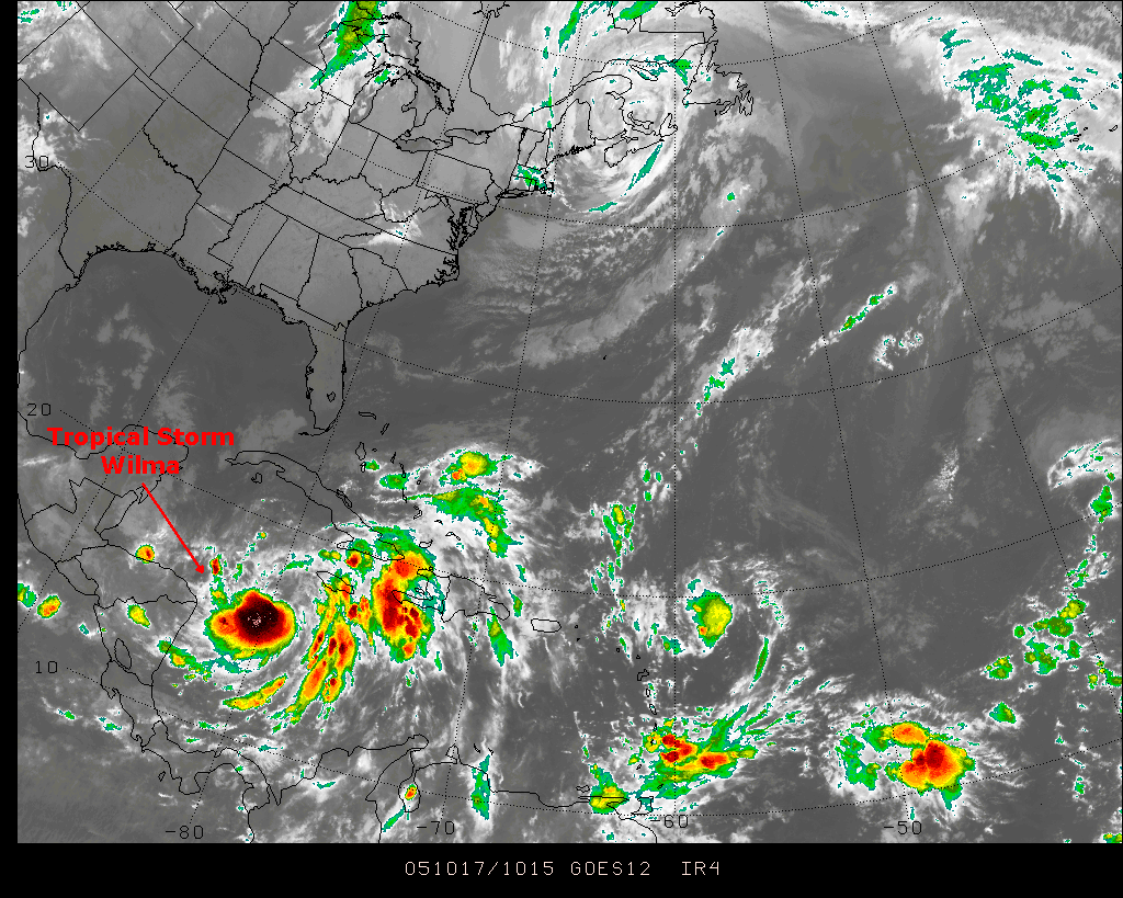
The depression drifted erratically over the next two days while slowly gaining strength. At 5am on the 17th, the system's sustained winds were now 35 knots (40mph), the barometric pressure was 1000mb and it was declared a tropical storm by the NHC. The infrared satellite image (below) from the morning of October 17th shows Wilma's location and overall structure.
|
||
Satellite image from 1015Z on October 17, 2005 from the Penn State E-wall showing the location and structure of Tropical Storm Wilma. |
||
Just 30 hours later at 11AM on the 18th, Wilma attained hurricane status and had a central barometric pressure of 977mb. NHC Advisory 12, issued at the same time, stated that "oceanic heat content ahead of Wilma is high. The only inhibiting factor is the dry air mass in the Gulf and extreme northwestern Caribbean...but the large and growing circulation of Wilma should be able to keep much of this air from reaching the core." All indications were that Wilma had plenty of potential for further intensification. Before proceeding with Wilma's story, let's examine the critical elements for hurricane formation and development.