Warning The Public
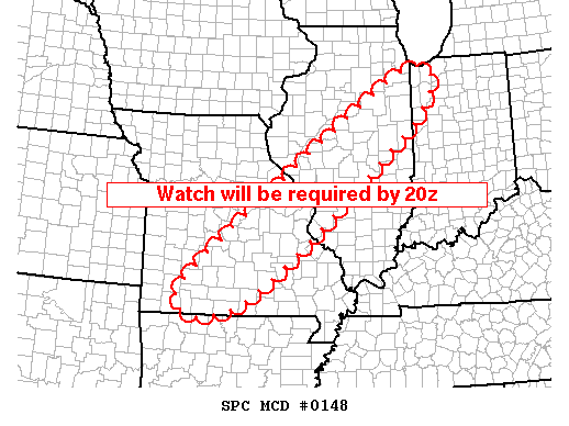
As February 16th wore on, forecasters at the SPC grew more concerned about the atmospheric conditions in the Midwest, and issued Mesoscale Discussion (MCD) #148 at 1245 PM CST. It warned of the potential for severe thunderstorms and tornadoes across much of southeastern Missouri and central Illinois. The MCD noted that:
CONVECTION IS DEEPENING AND SHOWERS ARE DEVELOPING RAPIDLY ALONG ADVANCING COLD FRONT FROM WEST CENTRAL IL INTO SOUTHWESTERN MO. ALTHOUGH INSTABILITY IS SOMEWHAT LIMITED ESPECIALLY ACROSS IL, STRONG LOW-MID LEVEL SHEAR WILL BE MORE THAN ADEQUATE FOR SUPERCELL STRUCTURES. LATEST THINKING IS THUNDERSTORMS WILL CONTINUE TO ORGANIZE WITH INITIAL DISCRETE STRUCTURES BECOMING MORE LINEARLY ORGANIZED ALONG WIND SHIFT BY LATE AFTERNOON. ISOLATED TORNADOES ARE POSSIBLE, HOWEVER DAMAGING WINDS WILL BECOME MORE COMMON AS CONVECTIVE MODE EVOLVES INTO A SQUALL LINE.
|
|
|
MCD Warning Graphic # 148 issued by the SPC at 1245 CST on February 16, 2006. |
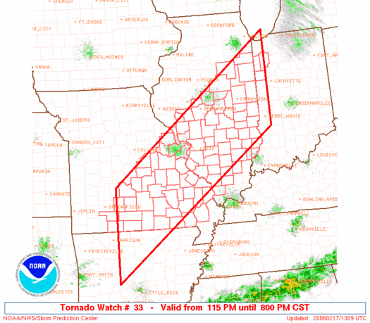
The line of storms passing through Missouri, Arkansas, Illinois, Kentucky and Indiana resulted in four Tornado Watches being issued on February 16th by the SPC:
-
Number 33: Issued at 115 PM CST
-
Number 34: Issued at 150 PM CST
-
Number 35: Issued at 355 PM CST
-
Number 36: Issued at 515 PM CST
 |
||||
|
Tornado Watches issued on February 16, 2006 by the SPC. |
||||
| Issued: | 115 PM CST | 150 PM CST | 355 PM CST | 515 PM CST |
It should be noted that a tornado watch warns that conditions are favorable for the formation of tornadoes and severe thunderstorms, and does not mean that a tornado has been sighted.
Next: Using Radar Imagery
Previous: Convective Indices
© 2005-2006 Mark A. Thornton