Introduction
The headline "Disaster Strikes" on the March 13, 2006 edition of The State Journal-Register left little doubt that the severe thunderstorm outbreak on the previous day had left its mark on Springfield, Illinois and the surrounding area. It certainly laid to rest a long-held belief that the city itself was immune from tornadoes because of the "heat island" effect. The theory suggests that tornadoes are incapable of invading an urban area due to the concentration of warmth related to human habitation. The adherents of this theory seem to have forgotten the F4 tornado that struck Springfield in 1957, resulting in two deaths and fifty injuries, and the May 3, 1999 outbreak of tornadoes in Oklahoma City, Oklahoma.
Introduction
Tornadoes Impact The Land of Lincoln
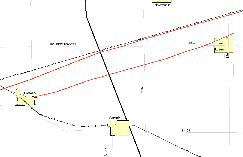
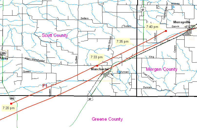
The first tornado touched down in southeast Pike County at approximately 729 PM CST. It moved slowly to the northeast across the rural counties of Green and Morgan and entered Sangamon County at 802 PM CST. The width of the tornado during this portion of its journey (nearly sixty-six miles) varied from 1/8 to 1/4 mile. A survey team from the NWS St. Louis office has estimated the tornado's strength at 100 mph, or an F1 on the Fujita Tornado Damage Scale.
 |
|
March 12, 2006 tornado tracks from NWS Lincoln, Illinois. |
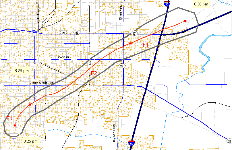
This same tornado continued on a northeasterly path and entered Springfield at approximately 820 PM CST with winds of approximately 120 mph (F2) and a path of destruction that ranged from 1/2 to 3/4 mile wide. During the next six minutes, with estimated winds of 120 mph, it scoured a 5.5 mile path through the city.
Just as this tornado was dissipating, a second F2 tornado formed at 825 PM CST in the same general area and continued along the same northeasterly path for nearly four miles. The resulting swath of damage from the two tornadoes was littered with uprooted trees, damaged homes and businesses, and snapped power poles. The municipal power plant was knocked offline at approximately 830 PM CST and left ninety percent of the city without electricity. Nearly sixty percent of Springfield's fifty severe weather sirens were silenced because they lacked battery backup. Miraculously, although approximately twenty people were injured, there were no fatalities.
As of April 1, 2006, field surveys by the NWS office at Lincoln, Illinois have documented that nine tornadoes formed in central Illinois on the evening of March 12, 2006.
-
Tornado One: Pike County to Sangamon County
-
Tornado Two: Sangamon County
-
Tornado Three: Morgan County to Sangamon County
-
Tornado Four: Sangamon County to Logan County
-
Tornado Five: Logan County
-
Tornado Six: Logan County
-
Tornado Seven: Scott County to Morgan County
-
Tornado Eight: Logan County to Macon County
-
Tornado Nine: Macon County to De Witt County
The map below displays the distribution of severe weather reports in central Illinois associated with the outbreak. In the immediate aftermath of the storm, it was estimated that nearly 1,700 homes and businesses in Springfield had been damaged, and nearly 1,000 homes had been rendered uninhabitable.
 |
|
Severe Weather Reports related to the March 12-13, 2006 outbreak, from the NWS office Lincoln, Illinois. |
Five central Illinois counties have been declared disaster areas by the Federal Emergency Management Agency (FEMA). The assistance associated with this declaration would help relieve the financial burden associated with reconstruction, estimated to be $34.1 million in Sangamon County alone.
 |
 |
 |
 |
 |
|
Damage photographs from the NWS Lincoln, Illinois. (click on the image to open full size) |
||||
As damaging as the storm was, according to Ed Shimon of the Lincoln, Illinois NWS office, it could have been much worse. In an interview conducted by The State Journal-Register, Mr. Shimon stated "the winds were right for it in terms of speed and direction ... but there wasn't enough instability to stretch the rotation as violently as some other storms ... that was the missing link that probably would have made the storm that went through Springfield an F5." One can only imagine the destruction that would have resulted from an increase in atmospheric instability.
Tornado Watches
The first Tornado Watch (#73) that included central Illinois was issued by the Storm Prediction Center (SPC) at 1150 AM CST (valid from 1150 AM until 840 PM CST) and warned of a particularly dangerous situation. As the warning graphic (below) shows, watch #73 covered a large swath of the Midwest, extending from eastern Kansas, through Missouri and into west central Illinois. The watch announced that:
There Is The Potential For Damaging Long Track Tornadoes Later This Afternoon And Evening.
 |
||
|
Tornado Watches for central Illinois issued by the SPC on March 12,2006. (Pass mouse over warning number to change image) |
#73 | #77 |
As Watch #73 expired, it was replaced by #77 (valid from 840 PM CST until 4 AM CST the following morning) which also warned that THIS IS A PARTICULARLY DANGEROUS SITUATION. The region under the watch had migrated to the east and encompassed virtually all of Missouri and Illinois. It included the following observations:
Widespread Severe Storms Are Affecting Parts Of Western/Central Missouri ... As Well As Parts Of Northern And Central Illinois. These Areas Will Continue To Be Affected By Supercell Storms Capable Of Very Large Hail ... Damaging Winds... And Strong Tornadoes.
Before we examine the atmospheric conditions in central Illinois, let's examine the synoptic weather pattern on March 12, 2006.
Next: Synoptic Picture
Restore the Frames Version
© 2005-2006 Mark A. Thornton